
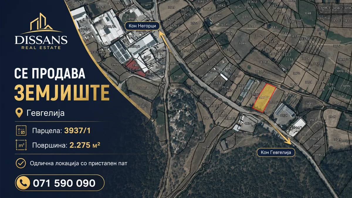


Key facts
Why consider this parcel
Its strongest advantages are concrete and verifiable:
- Confirmed G2 designation for light processing and less-polluting industry
- 2,275 m² in one clearly identified parcel
- Access from the existing local road
- Connections in both directions: Negorci and Gevgelija
- Water and electricity connection infrastructure on the parcel
- Transparent asking price of €60/m²
Industrial land with confirmed G2 designation
A 2,275 m² industrial parcel is offered for sale on the road connection between Gevgelija and Negorci, with a confirmed G2 urban planning designation for light processing and less-polluting industry.
The cadastral identification is parcel 3937/1 in Negorci, locality Lozarski Pat. The parcel has access from the existing local road, while infrastructure for obtaining water and electricity connections is available on the parcel itself. Connections are completed in accordance with the procedures and technical requirements of the relevant utility operators.
Location and access
The existing road connects the industrial parcel northward toward Negorci and southeast toward Gevgelija. Its confirmed G2 designation and road access support business-industrial planning.
Investment potential
The area, elongated form, road access, confirmed G2 designation and water and electricity connection infrastructure on the parcel provide a basis for carefully planning an industrial project. The specific solution must comply with the applicable G2 documentation and required approvals.
Potential directions of use
Within the confirmed G2 designation and applicable documentation, the parcel may be considered for:
- light processing and less-polluting industry
- a production or operational facility compatible with G2
- storage and logistics where permitted by the applicable G2 documentation
- service-oriented business-industrial activity or long-term industrial investment
Price and calculation
Asking price: €60/m². Area: 2,275 m². Total asking price for the full parcel: €136,500. Taxes, agency fees and transfer costs are not stated as included unless separately confirmed.
Documentation and verification
Before purchase, the buyer should review the current title record, documentation for the confirmed G2 designation and infrastructure conditions. The supplied maps and visuals are informative and are not an official current cadastral extract.
DISSANS Real Estate
Request detailed information, available documentation and a location visit.
The information is based on supplied data. Ownership, boundaries and the documentation for the confirmed G2 designation should be reviewed in the official records. Water and electricity connection infrastructure is available on the parcel; the connections themselves are completed in accordance with the procedures and technical requirements of the relevant utility operators.


